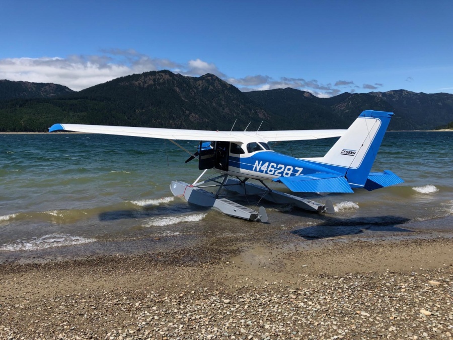
Flying cross-country in a float plane
Planning
Began a week out. Used Seaplane Pilots Association Water Landing Directory. First searched using Fuel on Water category. Got excited, so many options-won’t need to carry extra fuel in cans. Then called the listed phone numbers-most entries no longer accurate (base sold/closed, no longer offering fuel services, fuel offered is auto gas only). Then searched using Seaplane Bases and Body of Water categories. We focused on the bases/bodies of water near airports with fuel available. Lots of water options available MN and ND. Eastern MT drier other than Fort Peck Reservoir and Missouri River.
Extensive use of Google Maps- What does the body of water look like? What dock or beaching options are available? How close to the nearest airport (fuel) is it?
Wanted to keep legs about 2 hours long-body comfort and roughly the range of fuel carried in extra cans. Two 6-gal fuel cans came with plane and were carried in float locker.
Leaving Duluth, we wanted a short leg (~one hour) to get used to plane and turn around if needed but search to find adequate fuel stop stretched initial leg longer and longer. Options included:
- Brainerd Lakes Regional (KBRD)- Small lake next to airport but ruled out due to size. Confident of landing distance available, not of take-off distance available as we were at gross weight, unsure of plane’s capabilities, and unsure of surrounding terrain.
- Walker (Y49) on Leech Lake-Acceptable but better offer found at KDTL.
- Detroit Lakes-Wething Field (KDTL)-Detroit Lakes Aviation FBO very welcoming, said getting fuel would be no problem.
- Jamestown Regional (KJMS)-Too far for first leg and landing site too far from airport fuel, but would make following leg shorter.
Weather- Convenient that weather typically moves west to east. The weather being experienced in the Pacific Northwest would move across the US over a period of days. We were having a nice dry period in Seattle that seemed to follow Paul and me out to Duluth. There was cooler, cloudier weather foretasted for later in the week for the Seattle area. Nothing too drastic, however.
Developed two day Plan A and Plan B from Duluth:
Plan A
- Patterson Lake near Dickenson, ND (KDIK)-fuel
- Fort Peck Reservoir near Fort Peck (37S)-fuel/overnight
- Missouri River near Fort Benton (79S)-fuel
- Polson on Flathead Lake (8S1)-fuel
- Spokane River at Felts Field (KSFF)-fuel if needed
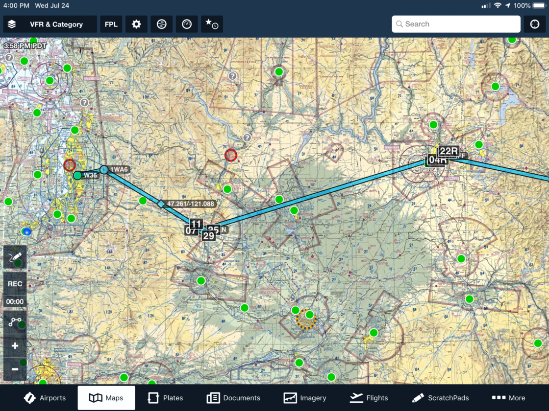
- W36-home
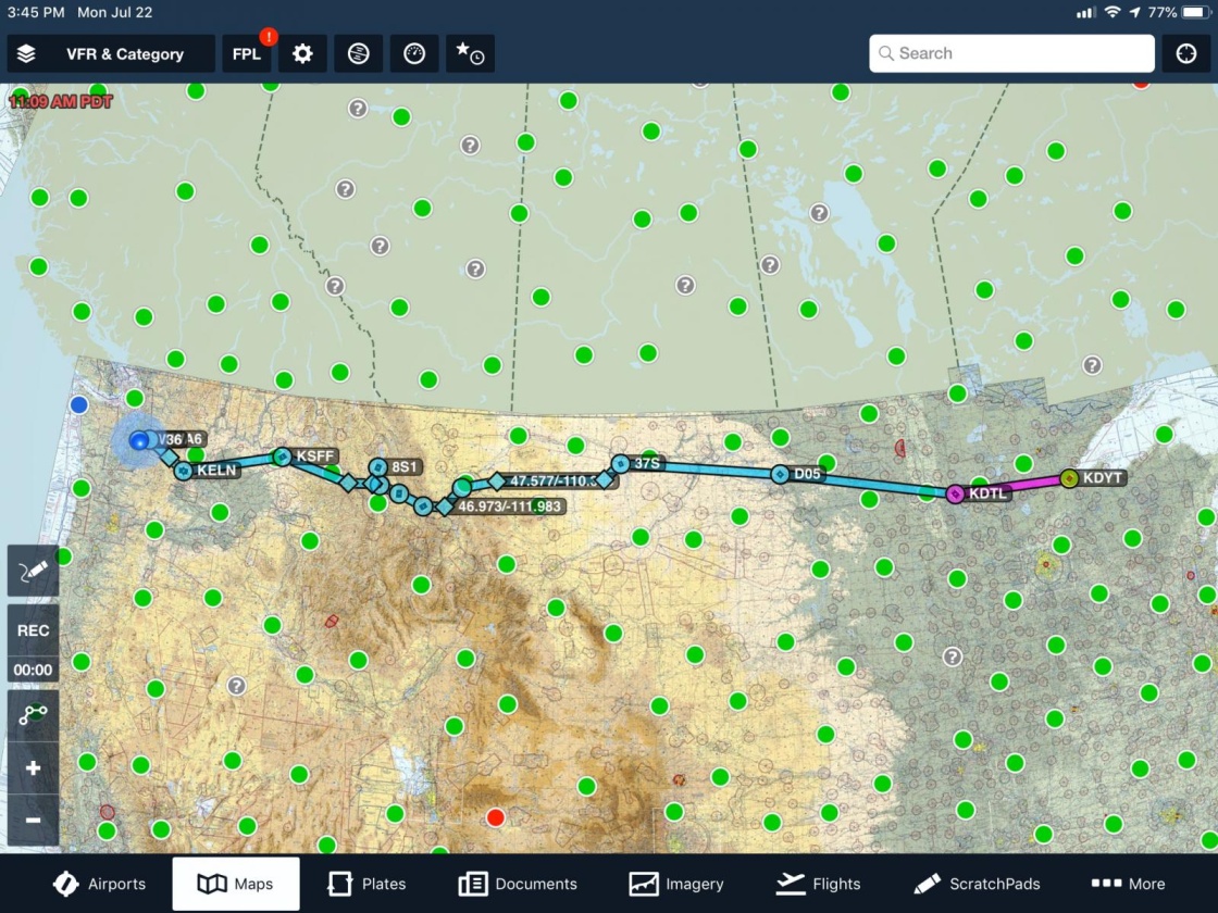
Plan B
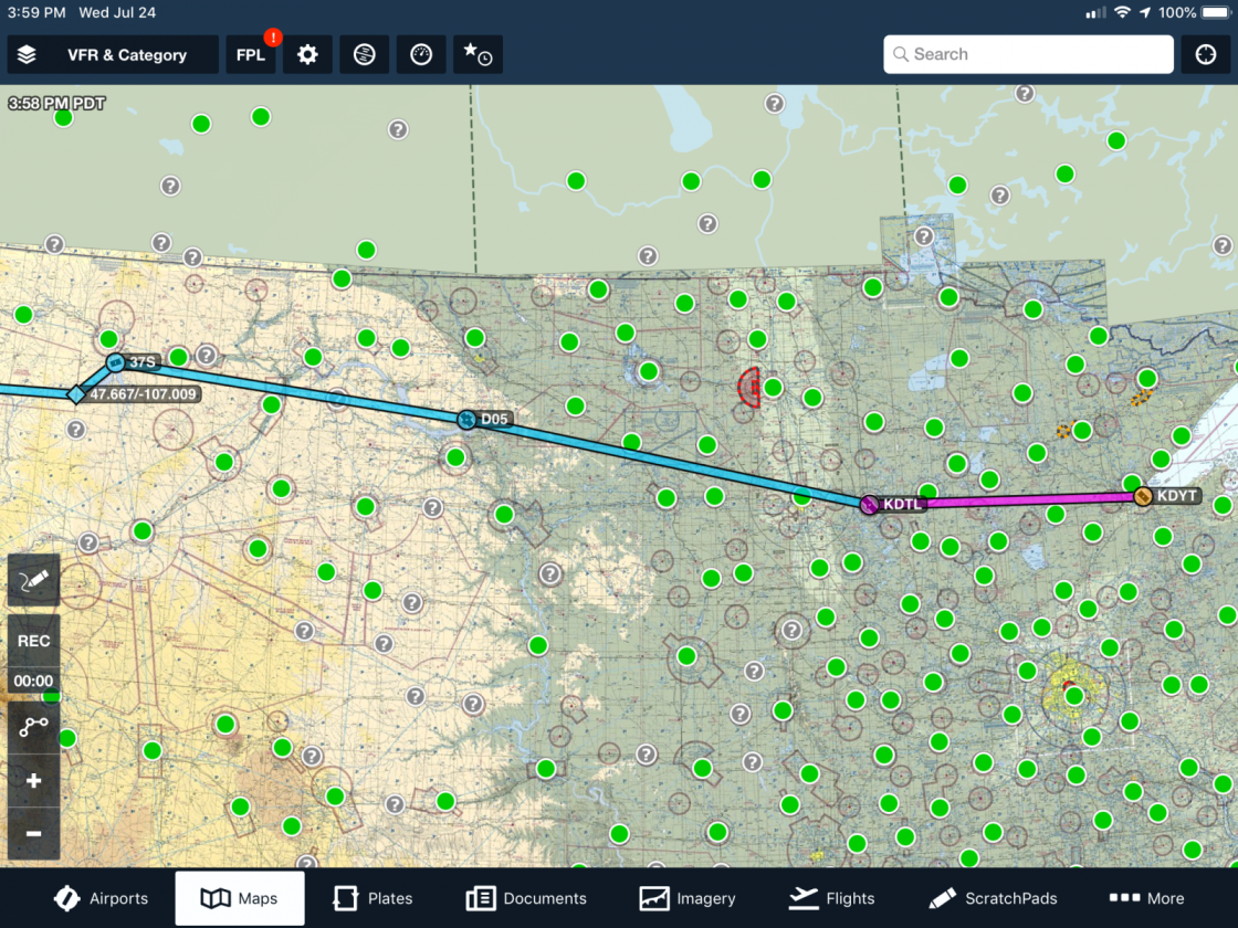
- Detroit Lake (KDTL)-fuel
- Ft Stevenson State Park, Garrison, ND (D05)- fuel
- Fort Peck Reservoir near Fort Peck (37S)-fuel and overnight
- Canyon Ferry Lake, Helena, MT-fuel
- Polson on Flathead Lake (8S1)-fuel
- Spokane River at Felts Field (KSFF)-fuel if needed
- W36-home
Patterson Lake would require long trips between the airport and lake for fuel, but FBO Western Edge Aviation did offer rides.
Fort Benton required landing on Missouri River and use of city boat ramp. No convenient docking found. Airport management did offer ride to airport for fuel. Current condition and speed of river was unknown. No other options nearby if the river was not safe.
Fort Stevenson State Park manager on Lake Sakakawea said they could transport fuel from nearby Garrison Airport. Added they had ice cream as well! Seemed very excited to have us come in.
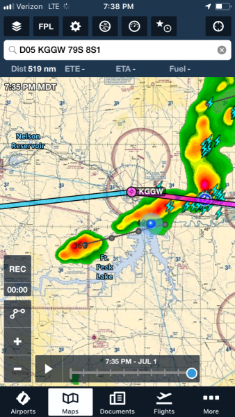
Fort Peck Marina was noncommittal regarding docking for night. We wondered if we were their first float plane to visit. Valley County Transit was willing to send a car to transport us to and from the reservoir to Wokal/Glasgow airport (KGGW) and hotel about 15 min away.
Leg between Fort Peck and Polson would require fuel stop. We weren’t comfortable with Ft Benton. Decided to go to Helena instead of Ft Benton. We did consider smaller lakes enroute to Helena (Kingsbury Lake and Big Lake) east of Great Falls but satellite view showed them as green, shallow or dry reservoirs. Maybe agriculture runoff water storage? We didn’t want to depend on them.
Even though big picture was to get to W36, planning focused on multiple small legs. Details of each leg was decided on the ground wherever we were at that time. Less pressure to make decisions when you’re on the ground. No plan was without its backup, including returning to leg’s starting point to start over if needed. Plan A and B legs could be interchanged, though that would make for less direct travel. We were very aware of need to be flexible with our planning as we weren’t familiar with the local flying areas and weather forecasts can always change.
Going to Duluth

Too long of layovers to fly into Duluth from Seattle, so we flew direct to Minneapolis-St. Paul. One way car rental was outrageously priced but we found a shuttle van that goes between Minneapolis-St. Paul and Duluth. Shuttle travel time was about 2 hours-about the same time as the flight in from Seattle. Flight to KMSP from KSEA was almost the same route we planned to use, just reverse and much faster. Nice to confirm satellite views from the internet with what we saw outside the jet’s windows.

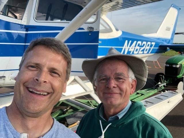
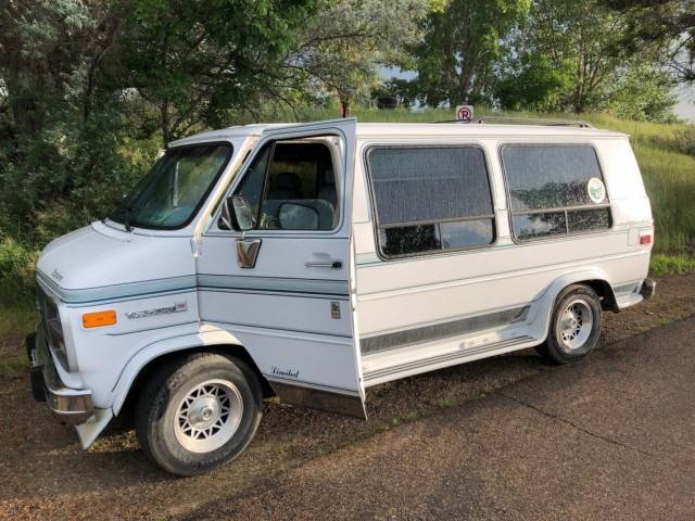
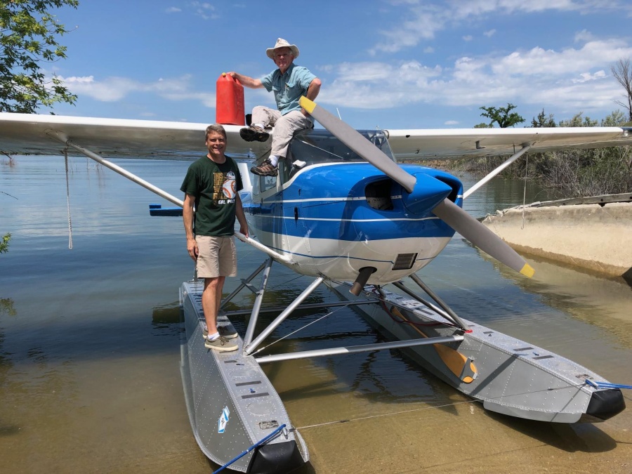
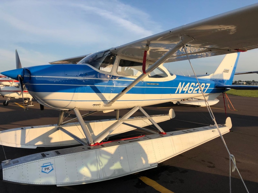
Lance, the seller, picked us up at the shuttle stop and took us to the plane at Sky Harbor KDYT. He is a fantastic person. Put me, a stranger to him, in his pilot seat and let me fly his plane to learn of any quirks. None found, very honest plane-just like its owner. We fueled the plane and gas cans in preparation for next day’s departure. Lance took us to our hotel and offered to pick us up next morning.
Plan Into Action - Day 1
Planned to be at Sky Harbor at 8 but found out breakfast didn’t open until then, so Lance joined us while we ate quickly. Paul and I decided on Detroit Lakes as first stop, because the FBO, Detroit Lakes Aviation, sounded very welcoming on phone. Leech Lake would be our back up. Flew over the Sky Harbor airport to let Lance get any last pictures of his plane.

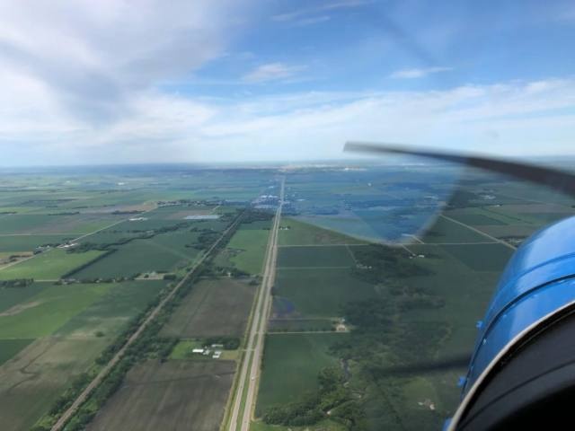
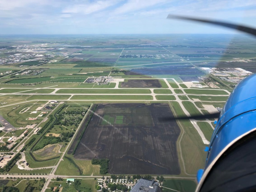
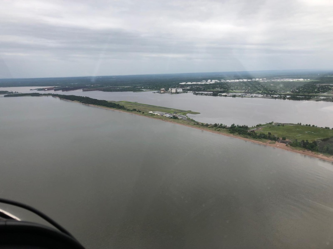
Reaching Detroit Lakes 1 ½ hours later, we circled lake to identify hazards, dock and ramp options. Landing was no problem, small dock at small boat ramp. Called Detroit Lakes Aviation and Tyler soon met us driving a quad pulling a small trailer. Trailer turned out to be a small fuel tank and pump. Refilled our wing tanks and we were back in the air quickly. This trip was going to be easier than we thought.

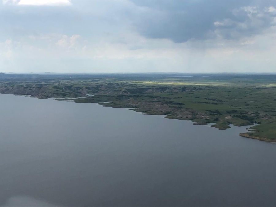
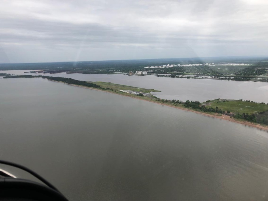
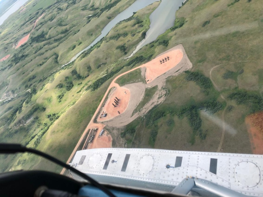
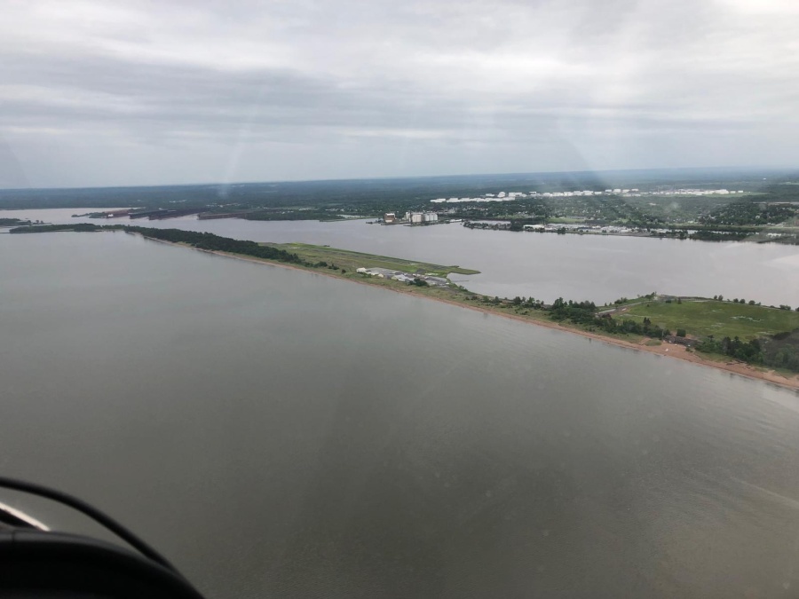
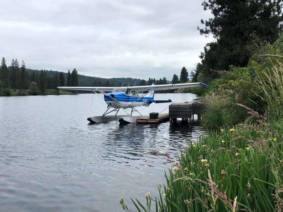
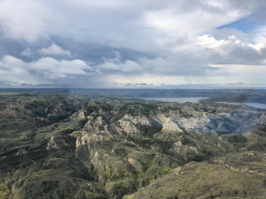
3 hour trip to Ft. Stevenson on Lake Sakakawea. HUGE reservoir! Circled the marina, found 3 or 4 ramp/beaching options. Landed. First ramp too busy with boaters, but shore next to it perfect. Only problem, someone left their paddle boards right where we wanted to beach the plane. Taxied the plane to Plan B location. Appears to be old, unused boat ramp. Even older ramp pulled on shore on one side and trees on the other. Pretty sure we can fit. After engine shut down and coasting to the ramp we bump into tree on right. Tighter fit than thought. Water only up to our calves at that point so got out and pulled plane around tree and up ramp.
Walked back to Park Concessions building. Run by teenagers. None know of conversation I had on phone with manager about transportation to Garrison for fuel (5 min away). They finally able to call someone and tell us someone can get us to the airport. While filling wing tanks using gas cans back at the plane, Park Ranger Juan shows up in his truck and offers us a ride. He gets us to the airport twice in order to finish wing tanks and refill gas cans. We offer to buy him ice cream at the concessions building while we eat lunch (long wait for lunch to be made). Juan was very friendly and generous with his time. Total time for fuel stop was about 1 ½ hour. Much longer than what we had at Detroit Lakes.
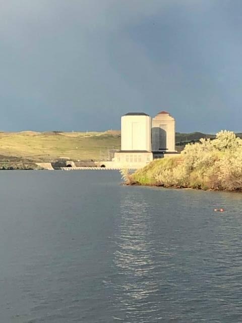
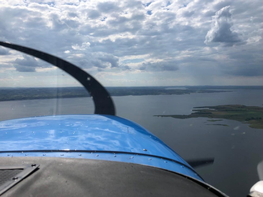
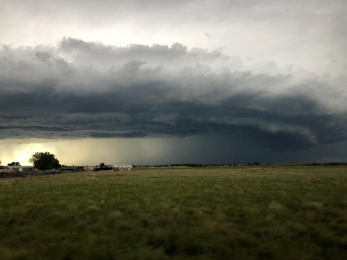
3 hour trip to Fort Peck Reservoir. Weather no concern today. See storm far to the west, no factor. Pass over smaller reservoirs. Paul sees one and describes it as a good place to land. We continue couple minutes further to marina, circle to check out landing/docking options. Turns out our circling was over homes on the Fort Peck airport. Three friends living there see us circling and decide to follow us to the marina to see who it is/help out. We land, wind is picking up, but sheltered in the marina. As Paul and I dock, three guys come running down the dock to help. Turns out that was a good thing as our new plane doesn’t have all the lines we’re used to having on the floats to make docking easier. After introductions they tell us a storm is coming and we don’t want to dock our plane here. There’s a much better place a couple of minutes back, right where Paul and described earlier!

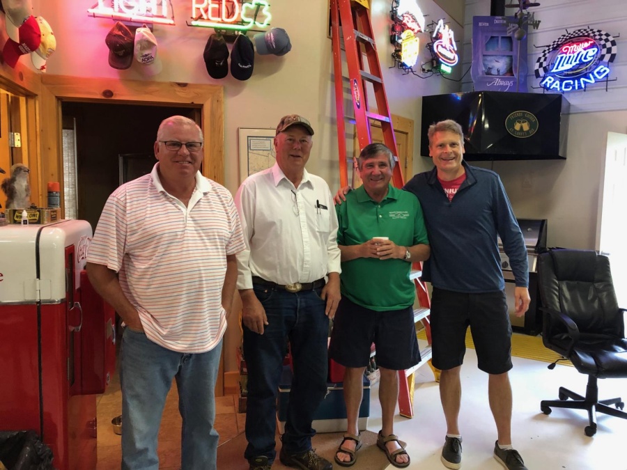
Paul went with them and I relocated the plane to the new location. Just in time. When we finished tying the plane up, the storm our new friends predicted arrived. Lots of rain, wind, lightning and thunder. But our beaching area was nicely protected from the wind. Lanny, Tim, and Tim take us back to their homes. Provide us with a van, extra line, and 4 gas cans to use for the night.
Paul and I return to the plane, use the extra line to doubly secure the plane and wait out the storm with the van just to be sure of the plane’s security. While there, we were asked on two separate occasions by nearby campers if we needed shelter from the storm. Very generous people found on this trip.
Storm passes and we use the van to travel 15 min north to Glasgow airport. At first fuel wouldn’t dispense from self-serve pump. This would be a problem as no other fuel available within flying range that we could land at in water. Paul finds valve in back turned off. Once turned on, pump works. Fill tanks and check in to Rustin Suites in town.
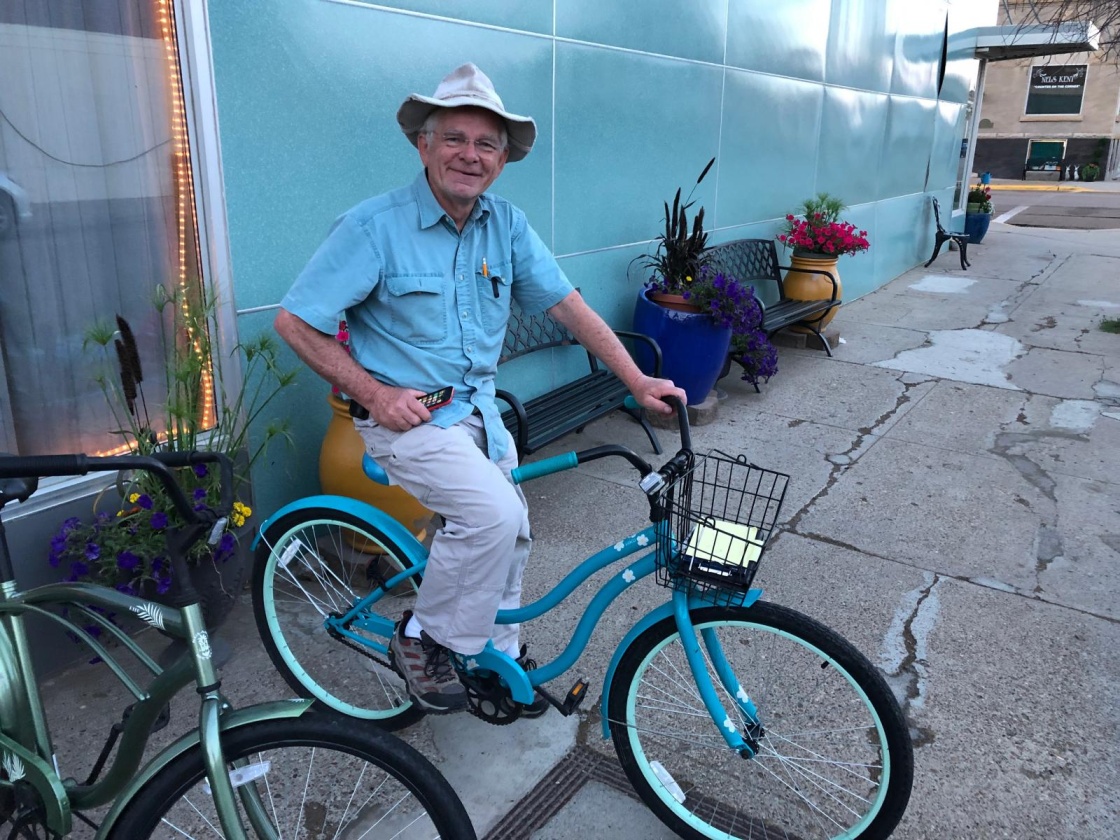
Fantastic hotel. Very old, but remodeled in the style of old train station hotel. They provide bikes to ride around town and suggest Eugene’s pizza. Paul and I enjoy the bike riding. Feel very good getting through day one with the generous people we’ve met and the ease of the trip.
Flying time 7.1 hours. Distance 596 nm.
Day 2
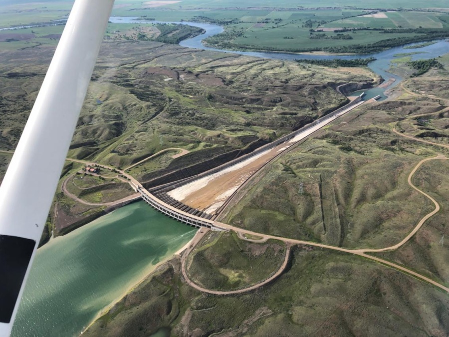
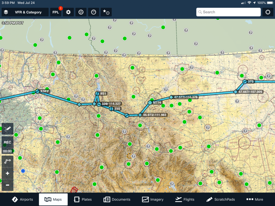
Morning arrives with low clouds. We decide to go to Canyon Ferry near Helena instead of Fort Benton because of uncertainty of river conditions and docking facilities there. Low clouds alright early as land still relatively flat, but more concern after Great Falls and the Rockies. We plan little lakes before Great Falls (Kingsbury and Big Lake) as options, but they look ugly. Fill van with gas, decide to eat McDonalds for quick breakfast (yuck), and buy donuts for our benefactors back at Fort Peck. We fill the plane’s tanks, return the van with donuts, and Lanny, Tim, and Tim return us to the plane to depart.
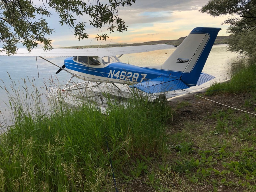
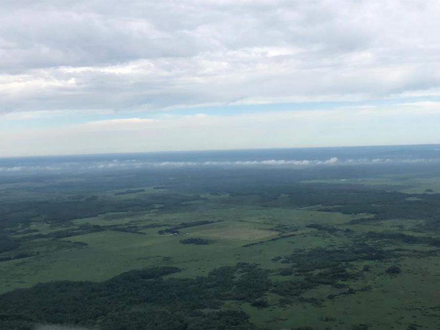
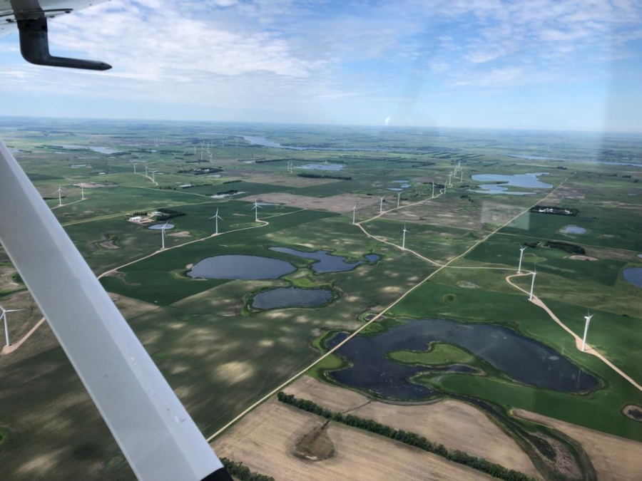
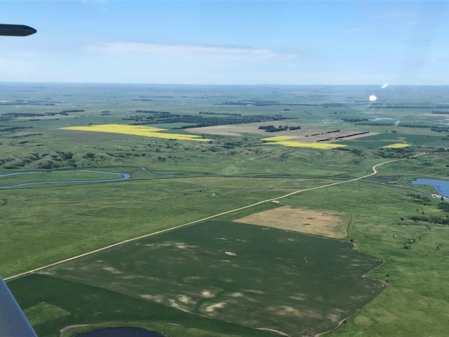
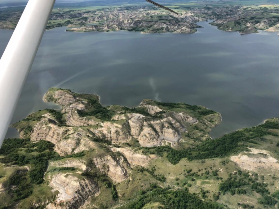
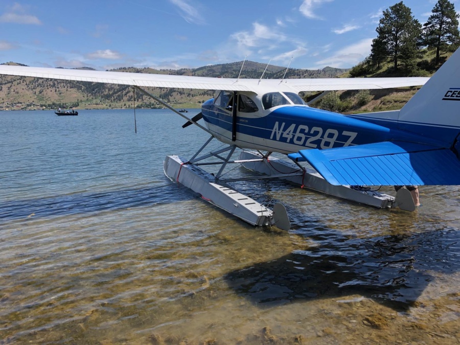
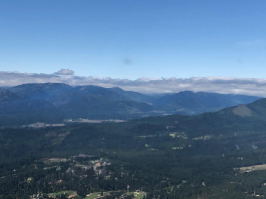
We stay 500’-1,000’ above the ground to remain out of the clouds for the first hour. Ceiling slowly rising as we progress westward. The lakes we considered as last resort east of Great Falls did look non-inviting as we saw on Google maps. After passing Great Falls, Paul is looking at possible landing sites on the Missouri River. The river conditions look okay, but the lack of beaching areas out of the river’s current makes the option less attractive. We keep the sites as back up in case we can’t get through the mountains or find we need to return for any other reason. The clouds break up as we head into the Rockies. Whew! When we decide to cut through one last pass to Helena, Paul finds Holter Lake. We circle around to check it out. Paul finds a nice beaching area. We land and use the gas cans to refill the wing tanks. Beautiful lake.
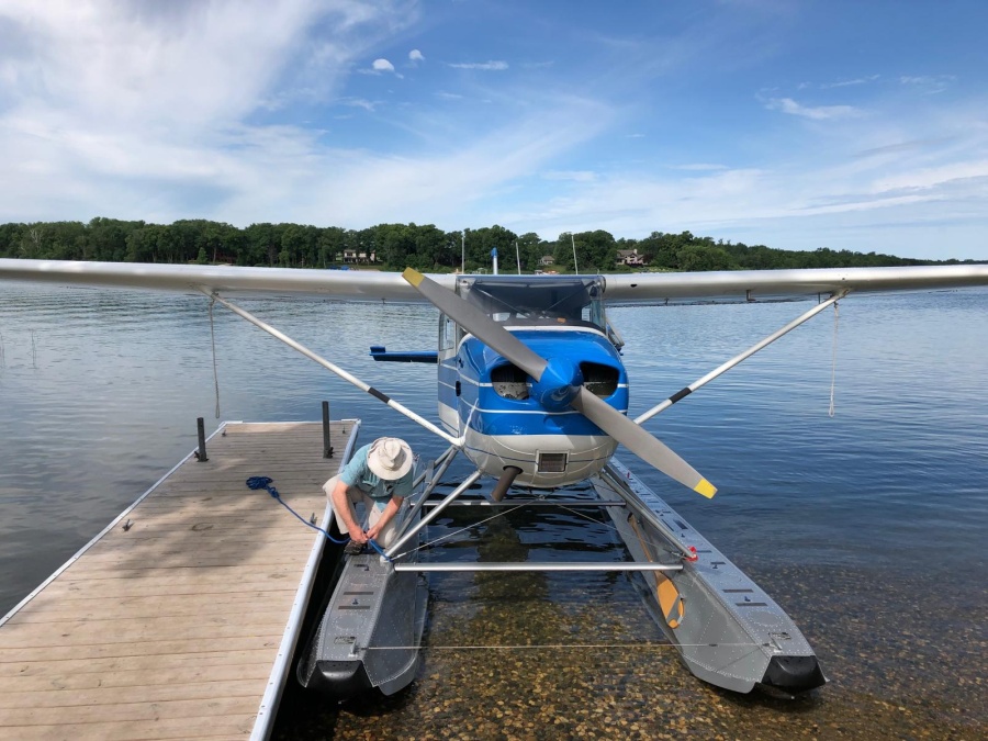
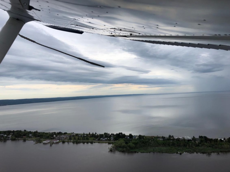
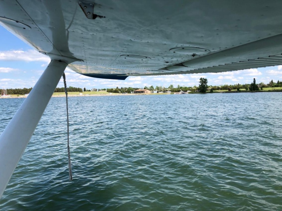
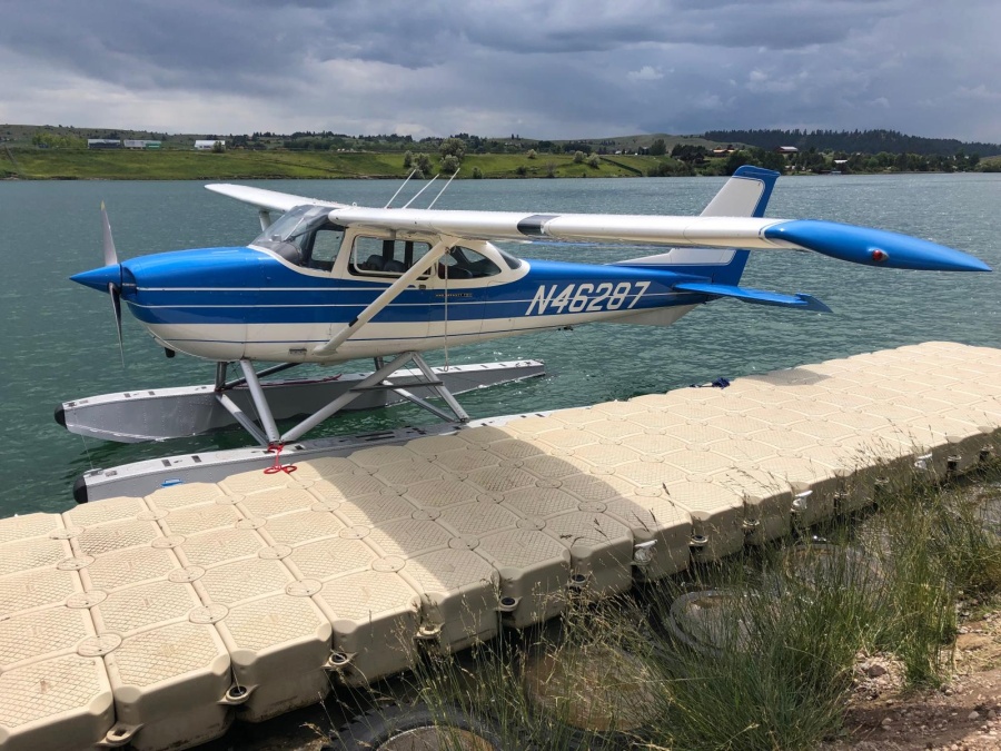
Easy trip through the passes of the Rockies for 1 ½ hours to Polson. Rain showers are around the Polson area, though, moving west to east. The seaplane base is in the mouth of the Flathead river that flows into the Flathead lake. Polson has nice dock to attach to and Vince, the airport manager meets us there in a gator vehicle to transport us from the dock to the fuel pumps. Another nice person giving us their time, asking nothing in return. After fueling, rain shower almost on top of us. Vince offers us a courtesy car to drive into town for lunch at Cover Sandwich and Pizza and wait out the shower.
Total time on the ground close to 2 hours. It’s becoming obvious that we will not be able to make Renton before dark. I call up friends in Spokane and arrange for us to stay with them overnight. A call to Western Aviation at Felts Field confirms we can get fuel and dock for the night.
The shower moves east and we take off. The first attempt upriver fails so we try the opposite direction. Turns out the wind changes direction in the river and we needed that extra help to get off the water.
We wind through valleys and finally connect with I-90 and follow it to Spokane. We realize that Montana is a very wide state and the part of Idaho we’re crossing is not.
Landing on the Spokane River is a kick. It is surrounded by a mountain on the north side and high banks on the south. And the river isn’t straight. We overfly the river first to identify our landing site and then fly a left pattern to land. Very fun approach! Miles meets us at the dock with the fuel truck and we refill the plane from the shore. Easy. Miles transports us and our baggage to the opposite side of the airport where we meet my friends and we stay at their house for the night. Plan is to leave for the airport at 8 next morning. We can make it to W36 without any fuel stops, but we have options to land in Moses Lake, Wenatchee, and Lake Chelan if we need to.
Flying time 6.8 hours. Distance 505 nm.
Day 3
The next day comes with low ceilings again. We arrive at the plane at 8 but have to wait an hour for the ceiling to rise for us to leave. We do know that clouds are packed on the west side of the Cascades, but they are forecasted to rise by late afternoon. Paul and I decide to fly to Cle Elum Lake and set down there to wait for the higher ceilings. The flight to Cle Elum Lake is quick and easy. Both of us excited to be close to home.
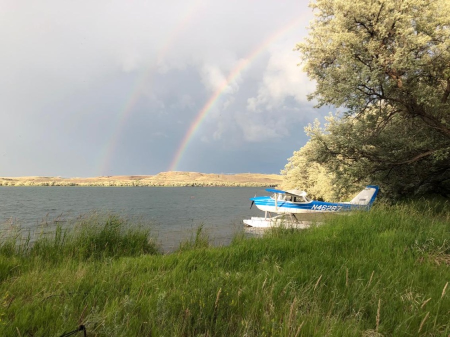
Winds at Cle Elum lake are strong enough to produce whitecaps, so we try to find a sheltered area to land after scoping out beaching options. Landing was okay, but difficult to maintain crosswind taxi to beach. We succeed and hang out for 1 ½ hours. Phones/tablets not getting good Wi-Fi signals so difficult to know weather conditions at pass. Find clubhouse that has wifi. Weather improving. Winds seem little stronger when we depart. New floats cut through rough water nicely.
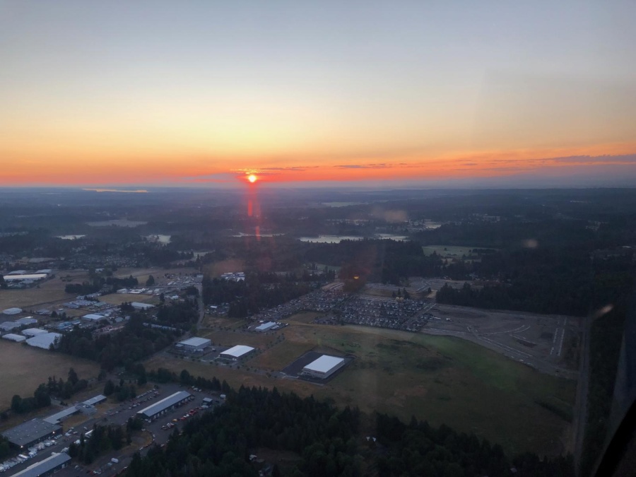
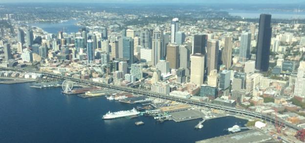
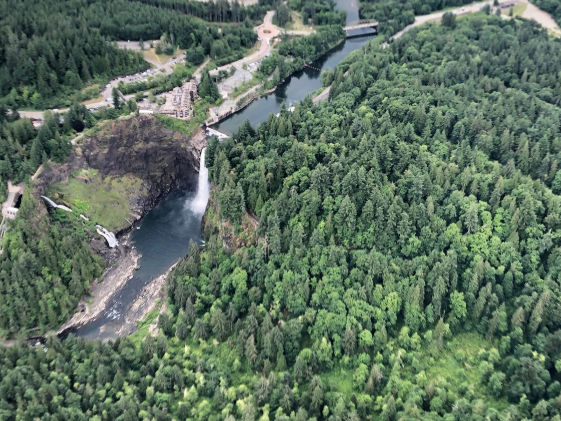
Fly through Snoqualmie Pass and descend under overcast on west side. Excited to see Snoqualmie Falls (part of scenic tour from W36). Radio starts to get scratchy outside Renton class D. Just able to communicate with tower. First technical issue of trip. Land and ramp at W36. Very happy with trip plan and plane.
Flying time 3.6 hours. Distance 214 nm.
Total flying time 17.5 hours. Total distance 1315 nm.
Click on photo to enlarge.